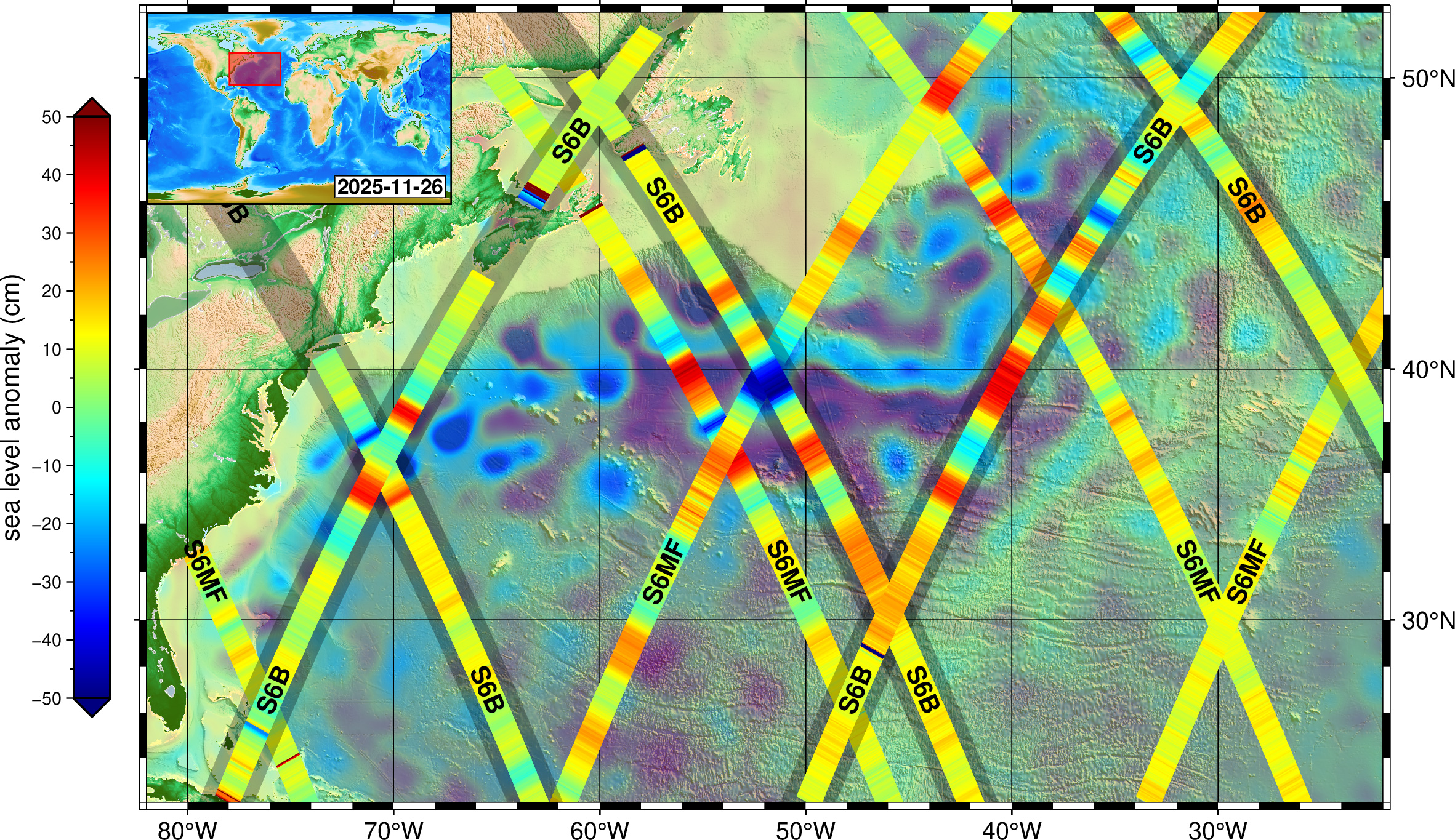
• NASA, Partners Share First Data From New US-European Sea Satellite Sentinel-6B and Sentinel-6 Michael Freilich captured data on Nov. • 26 of sea levels across a vast stretch of the Atlantic. • Within the crisscrossing bands, red indicates higher water relative to the long-term average; blue indicates lower water. • The tracks are layered atop the combined observations of other sea-level satellites. • Credit: EUMETSATFull Image Details Launched in November, Sentinel-6B will track ocean height with ultraprecision to advance marine forecasting, national security, and more. • Sentinel-6B, a joint mission by NASA and its U.S.
Article Summaries:
- NASA and its U.S. and European partners have released the first measurements from the Sentinel‑6B sea‑level satellite, launched in November. The preliminary data, shown in a map of the Eastern Seaboard and Atlantic Ocean, indicate sea‑level variations and are expected to be fully calibrated by next year. Sentinel‑6B, part of the Copernicus Sentinel‑6/Jason‑CS continuity of service mission, will also collect wind, wave, temperature and humidity data to support navigation, weather forecasting, national security and climate research. The satellite’s instruments are reported to be in good health, and the early results are considered promising for future operational use.
Sources: