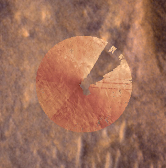
• Mars Global Localization Pinpoints Perseverance’s Location Downloads Mars Global Localization Pinpoints Perseverance’s Location PNG (566.29 KB) PIA26705 animation MP4 (2.77 MB) Description These images were part of the first successful use of a new technology called Mars Global Localization, developed at NASA’s Jet Propulsion Laboratory. • Using its navigation cameras, NASA’s Perseverance captured a 360-degree view of the surrounding terrain that was matched to orbital imagery, enabling the rover to pinpoint its location on Mars on Feb. • 2, 2026, the 1,762nd day, or sol, of the mission. • The navcam images were turned into an overhead view called an orthomosaic, forming a circle around the rover. • In this animation, the orthomosaic is superimposed on the imagery from NASA’s Mars Reconnaissance Orbiter (MRO). • Contrast and hue have been enhanced to increase visibility of terrain features, which align in the ground and orbital imagery.
Article Summaries:
- Description These images were part of the first successful use of a new technology called Mars Global Localization, developed at NASA’s Jet Propulsion Laboratory. Using its navigation cameras, NASA’s Perseverance captured a 360-degree view of the surrounding terrain that was matched to orbital imagery, enabling the rover to pinpoint its location on Mars on Feb. 2, 2026, the 1,762nd day, or sol, of the mission. The navcam images were turned into an overhead view called an orthomosaic, forming a circle around the rover. In this animation, the orthomosaic is superimposed on the imagery from NASA'
Sources: